
Thank you for supporting this site ❤️
Make a donation
Make a donation
Herat topographic map
Click on the map to display elevation.
Thank you for supporting this site ❤️
Make a donation
Make a donation
About this map
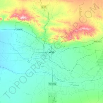
Name: Herat topographic map, elevation, terrain.
Location: Herat, Herat Province, 3005, Afghanistan (34.18914 62.05633 34.50914 62.37633)
Average elevation: 1,041 m
Minimum elevation: 882 m
Maximum elevation: 1,623 m
Thank you for supporting this site ❤️
Make a donation
Make a donation
Other topographic maps
Click on a map to view its topography, its elevation and its terrain.