
Thank you for supporting this site ❤️
Make a donation
Make a donation
Meighen Island topographic map
Click on the map to display elevation.
Thank you for supporting this site ❤️
Make a donation
Make a donation
About this map
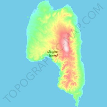
Name: Meighen Island topographic map, elevation, terrain.
Location: Meighen Island, Qikiqtaaluk Region, Nunavut, Canada (79.66950 -100.17665 80.15286 -98.62408)
Average elevation: 18 m
Minimum elevation: -1 m
Maximum elevation: 270 m
Thank you for supporting this site ❤️
Make a donation
Make a donation