
Stana topographic map
Interactive map
Click on the map to display elevation.
About this map
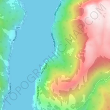
Name: Stana topographic map, elevation, terrain.
Location: Stana, Tyssedal, Ullensvang, Vestland, 5770, Norway (60.12050 6.55232 60.16050 6.59232)
Average elevation: 383 m
Minimum elevation: 0 m
Maximum elevation: 1,192 m