
50440 topographic map
Interactive map
Click on the map to display elevation.
About this map
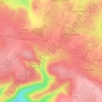
Name: 50440 topographic map, elevation, terrain.
Average elevation: 154 m
Minimum elevation: 56 m
Maximum elevation: 183 m
Other topographic maps
Click on a map to view its topography, its elevation and its terrain.
Le Hameau Sauvage
France > Normandie > Manche > La Hague > Beaumont-Hague
Le Hameau Sauvage, Beaumont-Hague, La Hague, Cherbourg, Manche, Normandie, France métropolitaine, 50440, France
Average elevation: 131 m