
Esmeralda County topographic map
Interactive map
Click on the map to display elevation.
About this map
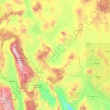
Name: Esmeralda County topographic map, elevation, terrain.
Location: Esmeralda County, Nevada, United States of America (36.97111 -118.42786 38.47353 -117.16565)
Average elevation: 1,789 m
Minimum elevation: 623 m
Maximum elevation: 4,301 m
Other topographic maps
Click on a map to view its topography, its elevation and its terrain.
Washoe County
United States of America > Nevada
Washoe County, Nevada, United States of America
Average elevation: 1,528 m
Churchill County
United States of America > Nevada
Churchill County, Nevada, United States of America
Average elevation: 1,476 m