
Thank you for supporting this site ❤️
Make a donation
Make a donation
Montone topographic map
Click on the map to display elevation.
Thank you for supporting this site ❤️
Make a donation
Make a donation
About this map
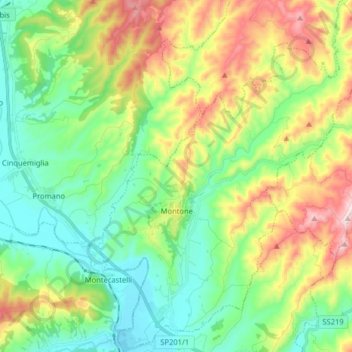
Name: Montone topographic map, elevation, terrain.
Location: Montone, Perugia, Umbria, 06014, Italy (43.31581 12.29050 43.43215 12.42405)
Average elevation: 403 m
Minimum elevation: 237 m
Maximum elevation: 731 m
Thank you for supporting this site ❤️
Make a donation
Make a donation
Other topographic maps
Click on a map to view its topography, its elevation and its terrain.