
Cetina topographic map
Interactive map
Click on the map to display elevation.
About this map
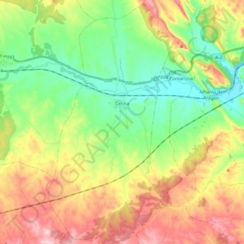
Name: Cetina topographic map, elevation, terrain.
Average elevation: 786 m
Minimum elevation: 649 m
Maximum elevation: 991 m
Other topographic maps
Click on a map to view its topography, its elevation and its terrain.
Cantales
Espagne > Aragon > Comunidad de Calatayud > Godojos
Cantales, Godojos, Comunidad de Calatayud, Saragosse, Aragon, Espagne
Average elevation: 778 m
Mara
Espagne > Aragon > Comunidad de Calatayud
Mara, Comunidad de Calatayud, Saragosse, Aragon, Espagne
Average elevation: 773 m