
Thank you for supporting this site ❤️
Make a donation
Make a donation
Reydon topographic map
Click on the map to display elevation.
Thank you for supporting this site ❤️
Make a donation
Make a donation
About this map
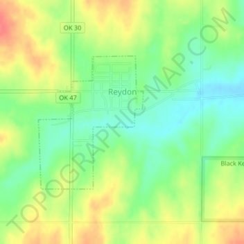
Name: Reydon topographic map, elevation, terrain.
Location: Reydon, Roger Mills County, Oklahoma, 73660, United States (35.64287 -99.93044 35.65759 -99.91616)
Average elevation: 708 m
Minimum elevation: 682 m
Maximum elevation: 739 m
Thank you for supporting this site ❤️
Make a donation
Make a donation
Other topographic maps
Click on a map to view its topography, its elevation and its terrain.