
Peru topographic map
Interactive map
Click on the map to display elevation.
About this map
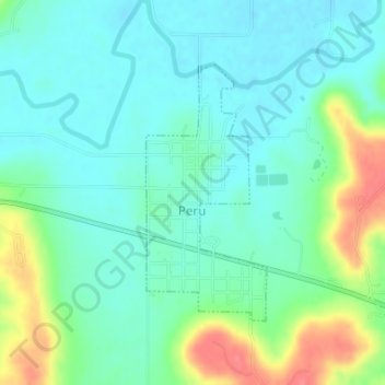
Name: Peru topographic map, elevation, terrain.
Location: Peru, Chautauqua County, Kansas, United States (37.07358 -96.10044 37.09158 -96.08982)
Average elevation: 253 m
Minimum elevation: 234 m
Maximum elevation: 302 m
Other topographic maps
Click on a map to view its topography, its elevation and its terrain.
Chautauqua County
United States > Kansas > Chautauqua County
Chautauqua County, Kansas, United States
Average elevation: 300 m