
Anderlecht topographic map
Interactive map
Click on the map to display elevation.
About this map
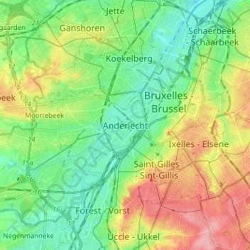
Name: Anderlecht topographic map, elevation, terrain.
Location: Anderlecht, Brussels-Capital, 1070, Belgium (50.79910 4.28965 50.87910 4.36965)
Average elevation: 50 m
Minimum elevation: 10 m
Maximum elevation: 119 m