
Thank you for supporting this site ❤️
Make a donation
Make a donation
Suwanee topographic map
Click on the map to display elevation.
Thank you for supporting this site ❤️
Make a donation
Make a donation
About this map
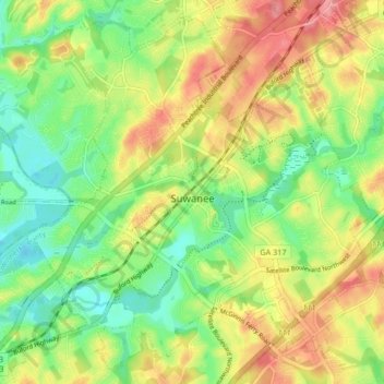
Name: Suwanee topographic map, elevation, terrain.
Location: Suwanee, Gwinnett County, Georgia, United States (34.02069 -84.10726 34.08439 -84.02404)
Average elevation: 311 m
Minimum elevation: 270 m
Maximum elevation: 361 m
Thank you for supporting this site ❤️
Make a donation
Make a donation