
Laufen topographic map
Interactive map
Click on the map to display elevation.
About this map
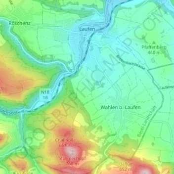
Name: Laufen topographic map, elevation, terrain.
Location: Laufen, Bezirk Laufen, Basel-Landschaft, 4242, Schweiz (47.38523 7.45617 47.42930 7.52310)
Average elevation: 455 m
Minimum elevation: 347 m
Maximum elevation: 733 m