
Comté de Boone topographic map
Interactive map
Click on the map to display elevation.
About this map
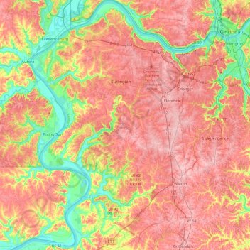
Name: Comté de Boone topographic map, elevation, terrain.
Location: Comté de Boone, Kentucky, États-Unis d'Amérique (38.77725 -84.89739 39.14780 -84.59797)
Average elevation: 224 m
Minimum elevation: 136 m
Maximum elevation: 293 m
Other topographic maps
Click on a map to view its topography, its elevation and its terrain.
McVille
États-Unis d'Amérique > Kentucky > Comté de Boone
McVille, Comté de Boone, Kentucky, États-Unis d'Amérique
Average elevation: 170 m
Burlington
États-Unis d'Amérique > Kentucky > Comté de Boone > Burlington
Burlington, Comté de Boone, Kentucky, 41005, États-Unis d'Amérique
Average elevation: 253 m