
Paffenhausen topographic map
Interactive map
Click on the map to display elevation.
About this map
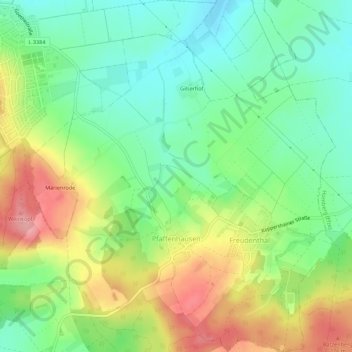
Name: Paffenhausen topographic map, elevation, terrain.
Location: Paffenhausen, Borken, Schwalm-Eder-Kreis, Hessen, Deutschland (51.01386 9.28615 51.04843 9.34040)
Average elevation: 227 m
Minimum elevation: 182 m
Maximum elevation: 295 m