
Thank you for supporting this site ❤️
Make a donation
Make a donation
Torr Head topographic map
Click on the map to display elevation.
Thank you for supporting this site ❤️
Make a donation
Make a donation
About this map
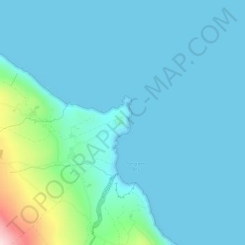
Name: Torr Head topographic map, elevation, terrain.
Location: Torr Head, County Antrim, Northern Ireland, United Kingdom (55.18596 -6.07325 55.20596 -6.05325)
Average elevation: 44 m
Minimum elevation: 0 m
Maximum elevation: 348 m
Thank you for supporting this site ❤️
Make a donation
Make a donation
Other topographic maps
Click on a map to view its topography, its elevation and its terrain.