
Uppariguda topographic map
Interactive map
Click on the map to display elevation.
About this map
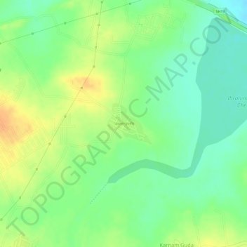
Name: Uppariguda topographic map, elevation, terrain.
Location: Uppariguda, Ibrahimpatnam mandal, Rangareddy, Telangana, India (17.18811 78.61207 17.19266 78.61727)
Average elevation: 536 m
Minimum elevation: 518 m
Maximum elevation: 554 m