
Samtskhé-Djavakhétie topographic map
Interactive map
Click on the map to display elevation.
About this map
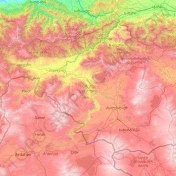
Name: Samtskhé-Djavakhétie topographic map, elevation, terrain.
Location: Samtskhé-Djavakhétie, Géorgie (41.10933 42.49199 41.94390 43.96659)
Average elevation: 1,818 m
Minimum elevation: 122 m
Maximum elevation: 3,277 m
Other topographic maps
Click on a map to view its topography, its elevation and its terrain.
დადეში
Géorgie > Samtskhé-Djavakhétie > Municipalité d'Akhalkalaki > დადეში
დადეში, Municipalité d'Akhalkalaki, Samtskhé-Djavakhétie, Géorgie
Average elevation: 1,910 m