
القرية topographic map
Interactive map
Click on the map to display elevation.
About this map
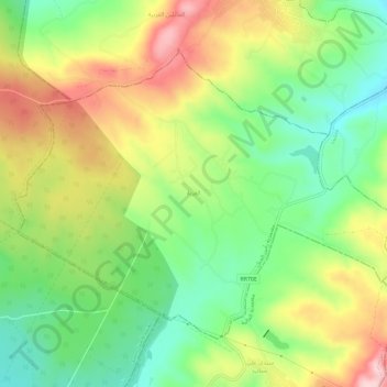
Name: القرية topographic map, elevation, terrain.
Location: القرية, رأس الجبل, Bizerte, Tunisia (37.20130 10.00813 37.23610 10.06624)
Average elevation: 144 m
Minimum elevation: 40 m
Maximum elevation: 281 m
Other topographic maps
Click on a map to view its topography, its elevation and its terrain.
Beni Nefaa
Tunisia > Bizerte > فرحات حشاد > Beni Nefaa
Beni Nefaa, فرحات حشاد, معتمدية بنزرت الجنوبية, Bizerte, Tunisia
Average elevation: 36 m