
Turi topographic map
Interactive map
Click on the map to display elevation.
About this map
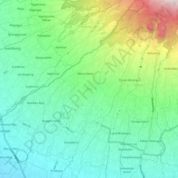
Name: Turi topographic map, elevation, terrain.
Location: Turi, Sleman, DIY, 555551, Indonesia (-7.68330 110.34371 -7.56536 110.41638)
Average elevation: 566 m
Minimum elevation: 248 m
Maximum elevation: 1,476 m