
Thank you for supporting this site ❤️
Make a donation
Make a donation
Les Haies topographic map
Click on the map to display elevation.
Thank you for supporting this site ❤️
Make a donation
Make a donation
About this map
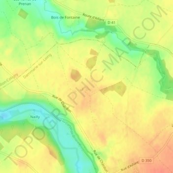
Name: Les Haies topographic map, elevation, terrain.
Average elevation: 152 m
Minimum elevation: 124 m
Maximum elevation: 170 m
Thank you for supporting this site ❤️
Make a donation
Make a donation
Other topographic maps
Click on a map to view its topography, its elevation and its terrain.
Dammarie-sur-Loing
France > Centre-Val de Loire > Loiret > Dammarie-sur-Loing
Average elevation: 160 m