
Thank you for supporting this site ❤️
Make a donation
Make a donation
Flemington topographic map
Click on the map to display elevation.
Thank you for supporting this site ❤️
Make a donation
Make a donation
About this map
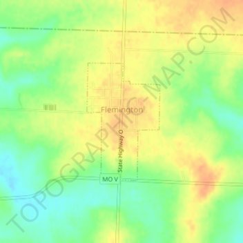
Name: Flemington topographic map, elevation, terrain.
Location: Flemington, Polk County, Missouri, United States (37.79686 -93.50624 37.80990 -93.49597)
Average elevation: 334 m
Minimum elevation: 313 m
Maximum elevation: 350 m
Thank you for supporting this site ❤️
Make a donation
Make a donation
Other topographic maps
Click on a map to view its topography, its elevation and its terrain.