Geolocate

Анадырь topographic map

Interactive map

Click on the map to display elevation.

About this map

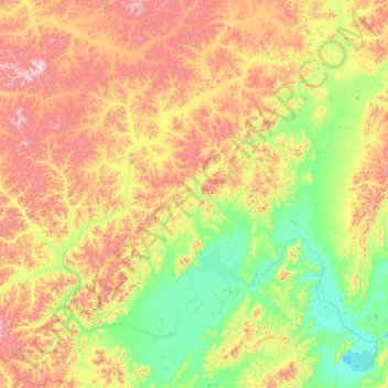
Name: Анадырь topographic map, elevation, terrain.

Location: Анадырь, Анадырский район, Chukotka, Distrito federal del Lejano Oriente, Rusia (64.64362 168.54262 67.04030 176.23180)

Average elevation: 359 m

Minimum elevation: 0 m

Maximum elevation: 1,586 m

Other topographic maps

Click on a map to view its topography, its elevation and its terrain.

Isla de Wrangel

Rusia > Chukotka

Isla de Wrangel, городской округ Эгвекинот, Chukotka, Distrito federal del Lejano Oriente, Rusia

Average elevation: 168 m

Анадырь

Rusia > Chukotka > Анадырь

Анадырь, городской округ Анадырь, Chukotka, Distrito federal del Lejano Oriente, 689000, Rusia

Average elevation: 19 m

Isla Ayon

Rusia > Chukotka

Isla Ayon, городской округ Певек, Chukotka, Distrito federal del Lejano Oriente, Rusia

Average elevation: 14 m