
Tscherlach topographic map
Interactive map
Click on the map to display elevation.
About this map
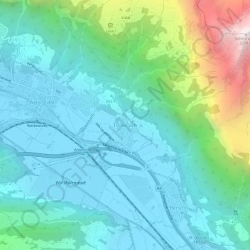
Name: Tscherlach topographic map, elevation, terrain.
Average elevation: 807 m
Minimum elevation: 422 m
Maximum elevation: 2,234 m
Other topographic maps
Click on a map to view its topography, its elevation and its terrain.
Flums
Schweiz > St. Gallen > Wahlkreis Sarganserland
Flums, Wahlkreis Sarganserland, St. Gallen, Schweiz
Average elevation: 1,328 m
Mels
Schweiz > St. Gallen > Wahlkreis Sarganserland
Mels, Wahlkreis Sarganserland, St. Gallen, Schweiz
Average elevation: 1,317 m