
Winnipeg topographic map
Interactive map
Click on the map to display elevation.
About this map
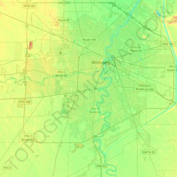
Name: Winnipeg topographic map, elevation, terrain.
Location: Winnipeg, Manitoba, Canadá (49.71355 -97.34915 49.99401 -96.95653)
Average elevation: 236 m
Minimum elevation: 222 m
Maximum elevation: 252 m
Other topographic maps
Click on a map to view its topography, its elevation and its terrain.
Fort Rouge–East Fort Garry
Fort Rouge–East Fort Garry, Winnipeg, Manitoba, Canadá
Average elevation: 234 m