
Choco topographic map
Click on the map to display elevation.
About this map
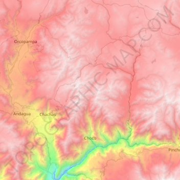
Name: Choco topographic map, elevation, terrain.
Location: Choco, Province of Castilla, Arequipa, Peru (-15.71174 -72.23765 -15.13545 -71.90141)
Average elevation: 4,289 m
Minimum elevation: 1,602 m
Maximum elevation: 5,672 m