
Thank you for supporting this site ❤️
Make a donation
Make a donation
Somatane topographic map
Click on the map to display elevation.
Thank you for supporting this site ❤️
Make a donation
Make a donation
About this map
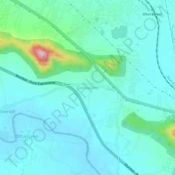
Name: Somatane topographic map, elevation, terrain.
Location: Somatane, Mawal, Pune District, Maharashtra, 410506, India (18.68345 73.66058 18.72345 73.70058)
Average elevation: 609 m
Minimum elevation: 566 m
Maximum elevation: 839 m
Thank you for supporting this site ❤️
Make a donation
Make a donation
Other topographic maps
Click on a map to view its topography, its elevation and its terrain.