
Una topographic map
Interactive map
Click on the map to display elevation.
Una
Una is located at 31°29′N 76°17′E / 31.48°N 76.28°E / 31.48; 76.28. It has an average elevation of 369 metres (1,210 feet). The elevation keeps temperatures cooler than surrounding lowlands, however, the area still experiences temperatures up to 45 °C (113 °F).
About this map
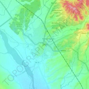
Name: Una topographic map, elevation, terrain.
Location: Una, Himachal Pradesh, 174300, India (31.42711 76.23205 31.50711 76.31205)
Average elevation: 389 m
Minimum elevation: 353 m
Maximum elevation: 515 m