
Prue topographic map
Interactive map
Click on the map to display elevation.
About this map
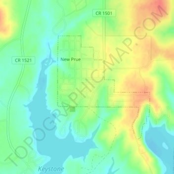
Name: Prue topographic map, elevation, terrain.
Location: Prue, Osage County, Oklahoma, Vereinigte Staaten von Amerika (36.24078 -96.27434 36.25679 -96.25574)
Average elevation: 239 m
Minimum elevation: 218 m
Maximum elevation: 268 m