
Thank you for supporting this site ❤️
Make a donation
Make a donation
Houston topographic map
Click on the map to display elevation.
Thank you for supporting this site ❤️
Make a donation
Make a donation
About this map
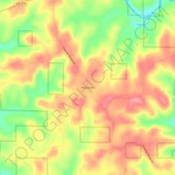
Name: Houston topographic map, elevation, terrain.
Location: Houston, Winston County, Alabama, 35572, United States (34.12149 -87.27807 34.16149 -87.23807)
Average elevation: 215 m
Minimum elevation: 156 m
Maximum elevation: 256 m
Thank you for supporting this site ❤️
Make a donation
Make a donation
Other topographic maps
Click on a map to view its topography, its elevation and its terrain.