
Thank you for supporting this site ❤️
Make a donation
Make a donation
Ratnanagar topographic map
Click on the map to display elevation.
Thank you for supporting this site ❤️
Make a donation
Make a donation
About this map
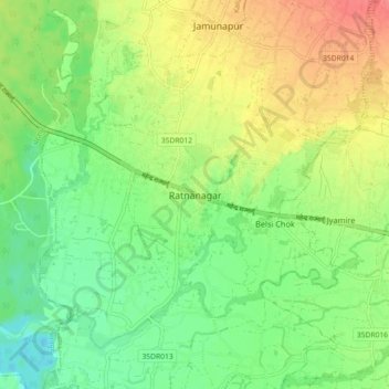
Name: Ratnanagar topographic map, elevation, terrain.
Location: Ratnanagar, Chitwan, Bagmati Province, 44204, Nepal (27.58182 84.47504 27.66182 84.55504)
Average elevation: 198 m
Minimum elevation: 172 m
Maximum elevation: 232 m
Thank you for supporting this site ❤️
Make a donation
Make a donation
Other topographic maps
Click on a map to view its topography, its elevation and its terrain.