
Ladera de Beges topographic map
Interactive map
Click on the map to display elevation.
About this map
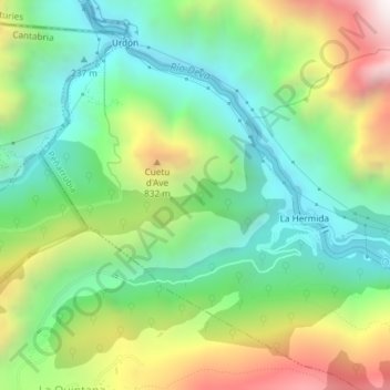
Name: Ladera de Beges topographic map, elevation, terrain.
Average elevation: 463 m
Minimum elevation: 68 m
Maximum elevation: 1,173 m
Other topographic maps
Click on a map to view its topography, its elevation and its terrain.
Cicera
España > Cantabria > Peñarrubia > Cicera
Cicera, Peñarrubia, Saja-Nansa, Cantabria, 39580, España
Average elevation: 666 m