
National Park "Caguanes" topographic map
Interactive map
Click on the map to display elevation.
About this map
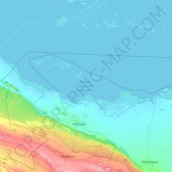
Name: National Park "Caguanes" topographic map, elevation, terrain.
Location: National Park "Caguanes", Sancti Spiritus, Cuba (22.33888 -79.35244 22.47473 -78.95465)
Average elevation: 41 m
Minimum elevation: -3 m
Maximum elevation: 311 m
Other topographic maps
Click on a map to view its topography, its elevation and its terrain.