
Oberdorf am Ipf topographic map
Interactive map
Click on the map to display elevation.
About this map
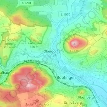
Name: Oberdorf am Ipf topographic map, elevation, terrain.
Average elevation: 523 m
Minimum elevation: 452 m
Maximum elevation: 674 m
Other topographic maps
Click on a map to view its topography, its elevation and its terrain.
Baldern
Deutschland > Baden-Württemberg > Ostalbkreis > Bopfingen
Baldern, Bopfingen, Verwaltungsgemeinschaft Bopfingen, Ostalbkreis, Baden-Württemberg, Deutschland
Average elevation: 527 m