
龙羊峡水库 topographic map
Interactive map
Click on the map to display elevation.
About this map
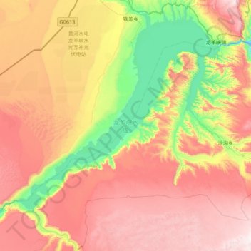
Name: 龙羊峡水库 topographic map, elevation, terrain.
Location: 龙羊峡水库, 共和县, 海南藏族自治州, 青海省, 中国 (35.69211 100.26477 36.21401 100.92811)
Average elevation: 2,964 m
Minimum elevation: 2,504 m
Maximum elevation: 3,474 m
Other topographic maps
Click on a map to view its topography, its elevation and its terrain.