
Sau Mau Ping Memorial Park topographic map
Interactive map
Click on the map to display elevation.
About this map
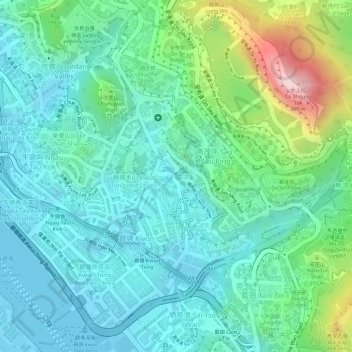
Name: Sau Mau Ping Memorial Park topographic map, elevation, terrain.
Average elevation: 102 m
Minimum elevation: -7 m
Maximum elevation: 399 m
Other topographic maps
Click on a map to view its topography, its elevation and its terrain.
Kwun Tong Promenade
Kwun Tong Promenade, 80, Kwun Tong, Sau Mau Ping, Kwun Tong District, Hong Kong, PRC
Average elevation: 21 m