
Thank you for supporting this site ❤️
Make a donation
Make a donation
Arkansas City topographic map
Click on the map to display elevation.
Thank you for supporting this site ❤️
Make a donation
Make a donation
About this map
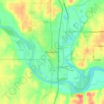
Name: Arkansas City topographic map, elevation, terrain.
Location: Arkansas City, Cowley County, Kansas, 67005, United States (37.02226 -97.07883 37.10226 -96.99883)
Average elevation: 339 m
Minimum elevation: 314 m
Maximum elevation: 376 m
Thank you for supporting this site ❤️
Make a donation
Make a donation