
Koro Island topographic map
Interactive map
Click on the map to display elevation.
About this map
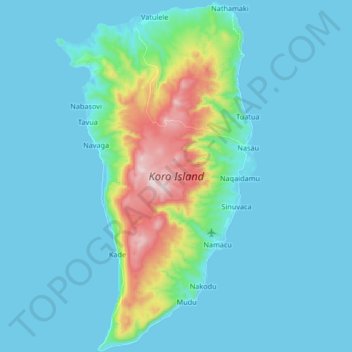
Name: Koro Island topographic map, elevation, terrain.
Location: Koro Island, Naqaidamu, Eastern, Fiji (-17.39932 179.34735 -17.24124 179.44278)
Average elevation: 74 m
Minimum elevation: -1 m
Maximum elevation: 537 m