
Thank you for supporting this site ❤️
Make a donation
Make a donation
Pernze topographic map
Click on the map to display elevation.
Thank you for supporting this site ❤️
Make a donation
Make a donation
About this map
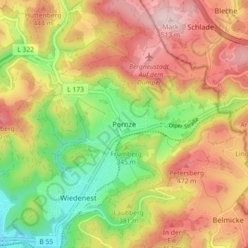
Name: Pernze topographic map, elevation, terrain.
Average elevation: 380 m
Minimum elevation: 232 m
Maximum elevation: 519 m
Thank you for supporting this site ❤️
Make a donation
Make a donation
Other topographic maps
Click on a map to view its topography, its elevation and its terrain.
Wiedenest
Deutschland > Nordrhein-Westfalen > Oberbergischer Kreis > Bergneustadt
Average elevation: 384 m
Wiedenest
Deutschland > Nordrhein-Westfalen > Oberbergischer Kreis > Bergneustadt
Average elevation: 361 m