
Hitzkirchen topographic map
Interactive map
Click on the map to display elevation.
About this map
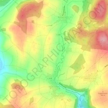
Name: Hitzkirchen topographic map, elevation, terrain.
Location: Hitzkirchen, Kefenrod, Wetteraukreis, Hessen, Deutschland (50.33488 9.22203 50.37262 9.25893)
Average elevation: 346 m
Minimum elevation: 269 m
Maximum elevation: 414 m