
Thank you for supporting this site ❤️
Make a donation
Make a donation
Eldridge topographic map
Click on the map to display elevation.
Thank you for supporting this site ❤️
Make a donation
Make a donation
About this map
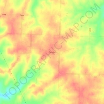
Name: Eldridge topographic map, elevation, terrain.
Location: Eldridge, Laclede County, Missouri, 65463, United States (37.80976 -92.76907 37.84976 -92.72907)
Average elevation: 349 m
Minimum elevation: 307 m
Maximum elevation: 370 m
Thank you for supporting this site ❤️
Make a donation
Make a donation
Other topographic maps
Click on a map to view its topography, its elevation and its terrain.