
Mund topographic map
Interactive map
Click on the map to display elevation.
About this map
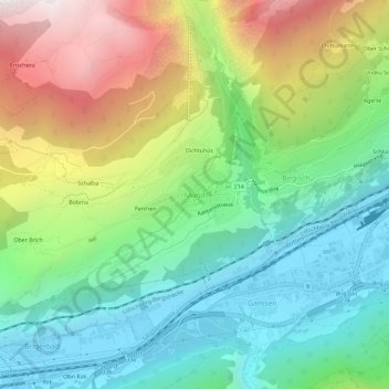
Name: Mund topographic map, elevation, terrain.
Location: Mund, Naters, Brig, Wallis, 3903, Schweiz (46.29529 7.92110 46.33529 7.96110)
Average elevation: 1,250 m
Minimum elevation: 650 m
Maximum elevation: 2,353 m