
Thank you for supporting this site ❤️
Make a donation
Make a donation
Melba topographic map
Click on the map to display elevation.
Thank you for supporting this site ❤️
Make a donation
Make a donation
About this map
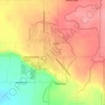
Name: Melba topographic map, elevation, terrain.
Location: Melba, Canyon County, Idaho, United States (43.36544 -116.54158 43.38086 -116.52360)
Average elevation: 798 m
Minimum elevation: 733 m
Maximum elevation: 837 m
Thank you for supporting this site ❤️
Make a donation
Make a donation
Other topographic maps
Click on a map to view its topography, its elevation and its terrain.