
Bærum topographic map
Interactive map
Click on the map to display elevation.
About this map
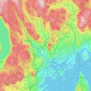
Name: Bærum topographic map, elevation, terrain.
Location: Bærum, Akershus, Norway (59.82574 10.34802 60.03223 10.65808)
Average elevation: 203 m
Minimum elevation: -1 m
Maximum elevation: 547 m
Other topographic maps
Click on a map to view its topography, its elevation and its terrain.