
Rosbach topographic map
Interactive map
Click on the map to display elevation.
About this map
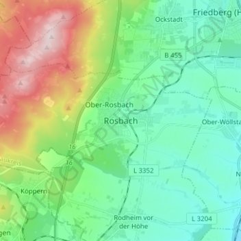
Name: Rosbach topographic map, elevation, terrain.
Average elevation: 227 m
Minimum elevation: 114 m
Maximum elevation: 512 m
Other topographic maps
Click on a map to view its topography, its elevation and its terrain.
Rodheim vor der Höhe
Deutschland > Hessen > Wetteraukreis > Rosbach v. d. Höhe > Rodheim vor der Höhe
Rodheim vor der Höhe, Rosbach v. d. Höhe, Wetteraukreis, Hessen, Deutschland
Average elevation: 187 m