
Sundarnagar topographic map
Click on the map to display elevation.
About this map
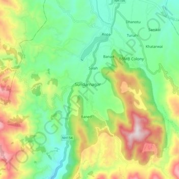
Name: Sundarnagar topographic map, elevation, terrain.
Location: Sundarnagar, Mandi, Himachal Pradesh, 175018, India (31.47820 76.84489 31.55820 76.92489)
Average elevation: 1,038 m
Minimum elevation: 733 m
Maximum elevation: 1,611 m
Other topographic maps
Click on a map to view its topography, its elevation and its terrain.