
Luxettipet topographic map
Interactive map
Click on the map to display elevation.
About this map
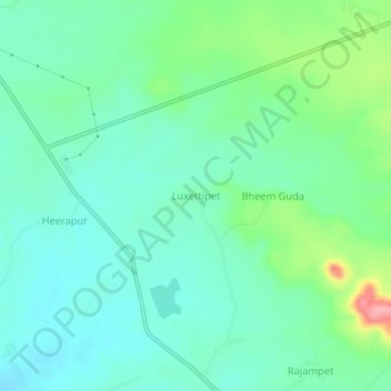
Name: Luxettipet topographic map, elevation, terrain.
Location: Luxettipet, Utnur mandal, Adilabad, Telangana, India (19.37654 78.75103 19.41654 78.79103)
Average elevation: 395 m
Minimum elevation: 366 m
Maximum elevation: 478 m