
La Encerrada topographic map
Interactive map
Click on the map to display elevation.
About this map
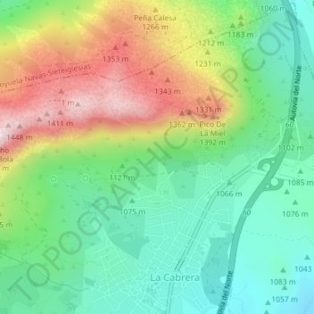
Name: La Encerrada topographic map, elevation, terrain.
Average elevation: 1,153 m
Minimum elevation: 981 m
Maximum elevation: 1,449 m
Other topographic maps
Click on a map to view its topography, its elevation and its terrain.
La Rabusera
España > Comunidad de Madrid > La Cabrera > La Rabusera
La Rabusera, La Cabrera, Sierra Norte, Comunidad de Madrid, 28751, España
Average elevation: 979 m