
Yeonseo-myeon topographic map
Interactive map
Click on the map to display elevation.
About this map
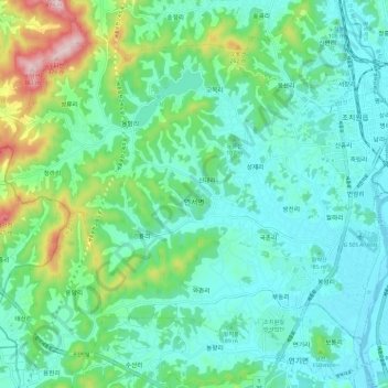
Name: Yeonseo-myeon topographic map, elevation, terrain.
Location: Yeonseo-myeon, Sejong, South Korea (36.54626 127.18868 36.61980 127.30588)
Average elevation: 92 m
Minimum elevation: 12 m
Maximum elevation: 367 m
Other topographic maps
Click on a map to view its topography, its elevation and its terrain.
Yeongi-myeon
South Korea > Sejong > Yeongi-myeon
Yeongi-myeon, Sejong, South Korea
Average elevation: 63 m
Garam-dong
South Korea > Sejong > Hansol-dong
Garam-dong, Hansol-dong, Sejong, 30065, South Korea
Average elevation: 23 m