
Savadatti taluku topographic map
Interactive map
Click on the map to display elevation.
About this map
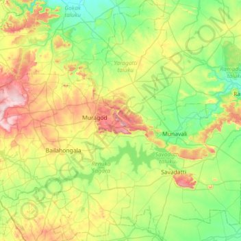
Name: Savadatti taluku topographic map, elevation, terrain.
Location: Savadatti taluku, Belgaum district, Karnataka, India (15.60957 74.80136 16.15770 75.31954)
Average elevation: 661 m
Minimum elevation: 551 m
Maximum elevation: 901 m
Other topographic maps
Click on a map to view its topography, its elevation and its terrain.