
Stevens County topographic map
Interactive map
Click on the map to display elevation.
About this map
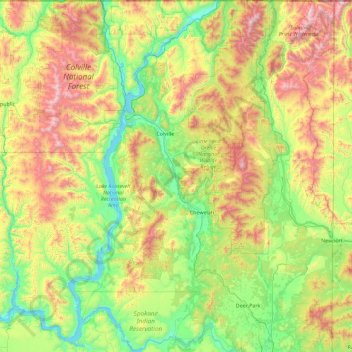
Name: Stevens County topographic map, elevation, terrain.
Location: Stevens County, Washington, Vereinigte Staaten von Amerika (47.79196 -118.39912 49.00074 -117.43255)
Average elevation: 924 m
Minimum elevation: 381 m
Maximum elevation: 2,290 m